topografic mapping with professional drones
Topographic mapping
The territory at your fingertips
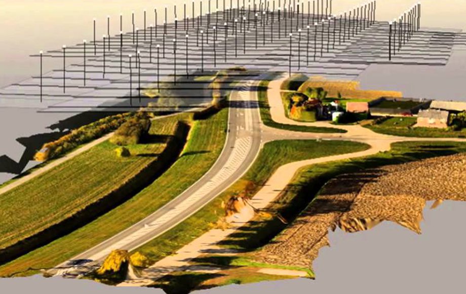
The technologies of UAV and modelling have brought about revolutionary advances in the field of topographic surveying and mapping.
There is increasingly widespread use of photographs and images that, when properly processed with specific software, and then enhanced with tools of observation, provide countless elements of information. When this output is consistent and reliable, it can easily replace, in every way, shape and form, the more invasive, costly techniques used at present. Relying on a team of expert, highly skilled professionals is always the best approach.
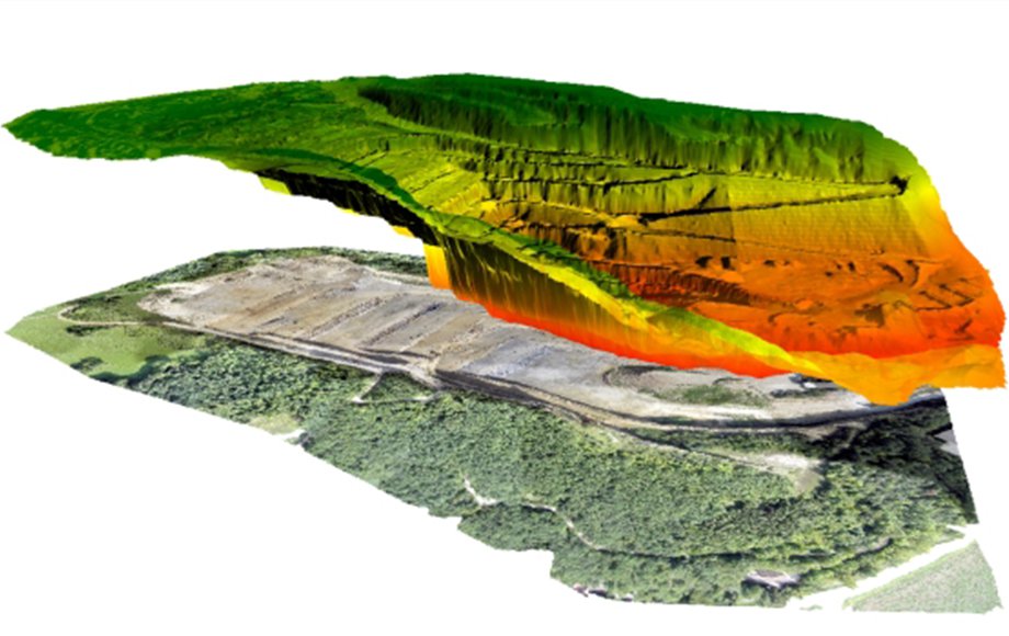

The best possible dataset, combined with expertise in the field of GIS observation, makes it possible to map the lay of the land using models of high precision and accuracy to obtain cross-sections, contour lines and any other measurement called for.
Precise, focussed, reliable data obtained by mixing and matching traditional technologies (such as Lidar) with topographical tools based on more modern UAS technology guarantee maximum reliability of the information being sought.
Italdron is present throughout Italy, with the staff of its Service Network guaranteeing rapid response, plus the highest possible levels of professional skills and know-how, for every need.
The Italdron team can offer approaches capable of providing effective responses to the need to speed up procedures for the output of precise, focussed information, drawing on software such as Bentley Context Capture 3D, the professional system that can point to the highest level of data accuracy, plus numerous tools of measurement and surveying.